To outer space and the deep ocean, add “beneath the ice” to the list of rarely charted frontiers of science exploration.
There have been very few expeditions where robots dived beneath polar ice shelves to characterize and measure them. UC Davis engineering professor Alexander Forrest recently returned from one of them.
Forrest led a six-member robotics team in Antarctica on the Western Ross Sea and Terra Nova Bay as part of an international expedition, LIONESS, led by the Korea Polar Research Institute. That stands for Land-Ice/Ocean Network Exploration with Semiautonomous Systems.
The team spent nearly two months in January and February aboard the South Korean icebreaker R/V Araon.
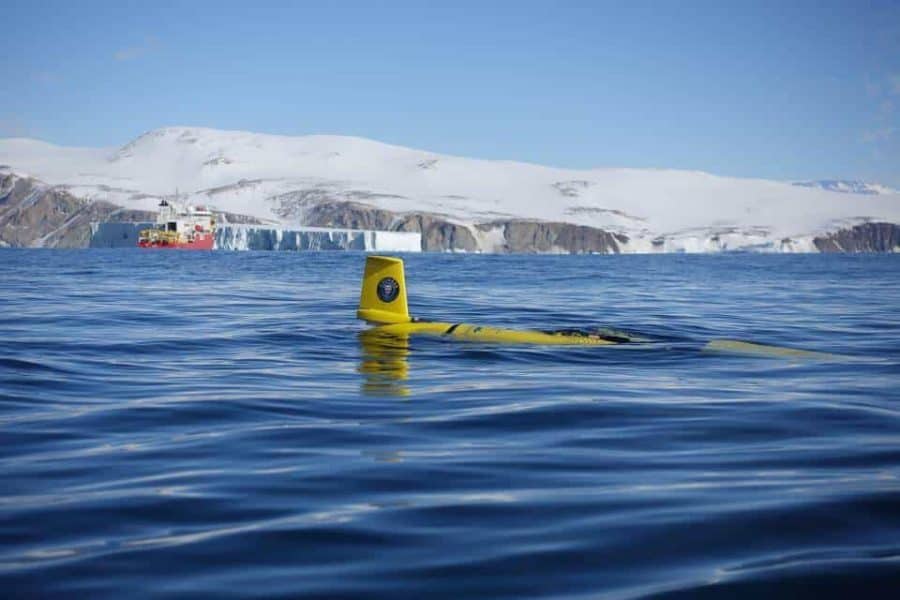
Their mission? Deploy two robots, or autonomous underwater vehicles (AUV) — one to dive beneath the sea ice to map the bottom of the Nansen ice shelf, from which two Manhattan-sized icebergs broke last year. The other, a glider with wings named Storm Petrel, to patrol the front of the ice shelf for 10 days, looking for evidence of freshwater and capturing change over time.
Why? Ultimately, to better predict how — and when — ice shelves collapse.
“Ice shelves are melting,” Forrest said. “We know this. But we don’t know how fast they’re melting. To actually make on-site measurements is the next step. We’re trying to get a baseline understanding of what changes are happening in the Antarctic. As a global community, we don’t really understand what we’re losing.”
From one pole to the other
This July, the team will head in the opposite direction, to the Arctic’s Milne Fjord, where Forrest and colleagues plan to study the last epishelf lake in Canada.
Epishelf lakes form when meltwater flowing off a glacier is trapped behind a floating ice shelf. As ice shelves in the Arctic disappear, so do the epishelf lakes dammed behind them. While Canada may soon be epishelf-free, others remain in Greenland and Antarctica. The research is intended to better explain time scales, as ice shelves are melting faster than scientists earlier predicted.
“It comes down to understanding how this environment is now so we can understand how potential future climate scenarios will drive these systems in Greenland and Antarctica, as well,” Forrest said.
Ice glider to deploy at Lake Tahoe
When not swimming alongside polar ice, the Storm Petrel glider trades the ocean for freshwater. It’s currently settling in to its new home at Lake Tahoe, which stretches across the California and Nevada borders. The UC Davis Tahoe Environmental Research Center plans to deploy it in the lake early this summer.
The plan is for the glider to take continuous measurements, provide real-time information to TERC’s network of instrumented buoys, chase storm events, and ultimately help round out the picture of the processes and impacts affecting Lake Tahoe.
“Lakes are highly variable, both spatially and in time,” said Geoffrey Schladow, director of the UC Davis Tahoe Environmental Research Center. “Conventional measurements cannot capture this dynamism. But with a glider operating for weeks at a time, from the surface to the very bottom, we finally have the appropriate tool.”
Lake Tahoe is getting “smarter” all the time with its network of nearshore sensors, NASA buoys and good old-fashioned manual sampling from TERC’s research vessel. But the glider can do something those other tools cannot: Move around the lake in bad weather and rough conditions.
And, as nearly everyone who studies freshwater lakes can attest, bad weather — with its mixing, churning, swelling and upwelling — is when everything really interesting happens in a lake.
Be it at the poles, or in a California lake, the data these robots collect are helping to shape the picture of how aquatic environments are changing, and what might be expected in the years to come.


