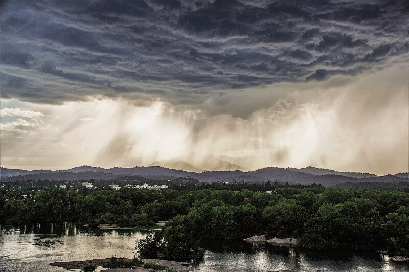
Abarrage of storms starting in late December 2022 highlighted the dangers of “whiplash weather,” a pattern of swings between heavy winter rainfall and severe summer drought in the western U.S.
Stanford scholars and the public information manager for Sacramento County – an area that saw some of the heaviest damage from recent state-wide flooding – discussed the science behind the storms, implications for drought recovery, and tools to help communities mitigate future risk. The Jan. 18 event was the latest in a series of webinars hosted by the Stanford Woods Institute for the Environment to explore the connections between climate science, extreme weather events, and inequitable impacts across communities.
Expect the unexpected
Much of the precipitation in the western U.S. each year falls from atmospheric rivers – narrow bands in the atmosphere that act like highways for transporting moisture from the tropics to higher latitudes. But the rapid succession of this year’s atmospheric rivers was highly unusual, according to Noah Diffenbaugh, a professor of Earth system science in the Stanford Doerr School of Sustainability. The back-to-back rains triggered landslides, filled up stormwater drains, and flooded communities as infrastructure and the natural landscape were quickly saturated.
Even with advances in artificial intelligence and computing power for short-term precipitation forecasting, “there are real limits to our abilities to know the future,” said Diffenbaugh. “Where we can really take action is on our systems and practices and implementation for being prepared.”
Jenny Suckale, an assistant professor of geophysics in the Stanford Doerr School of Sustainability, emphasized that a problem-solving mindset is essential as climate change increases uncertainty and pushes existing infrastructure toward risk.
“A lot of planning efforts choose one design event and then try to mitigate the risks for that particular event,” said Suckale. “The drawbacks of that is that two floods don’t tend to be alike.”
Suckale’s research group is working with San Francisco Bay Area stakeholders and community members to plan for a wide spectrum of possible flood events by improving risk assessment and understanding community needs in the context of existing inequity.
Recognize a shifting landscape
“The one factor that has changed isn’t where the water is coming from; it’s where the water is hitting,” said Matt Robinson, public information manager for Sacramento County. Neighborhoods have been constructed in areas that were previously farmland, which changes how floodwaters move and increases the number of people and homes at risk from flooding.
Robinson spends a large part of his time explaining to people in the Sacramento region that they live in a floodplain, despite what they might observe from all-too-familiar dry conditions. Although the recent rains have downgraded much of California from “extreme” to “severe” drought status, maintaining those levels will depend on how much precipitation falls in the remainder of the year.
Look to natural infrastructure
Climate change is increasing demands on engineered infrastructure like dams, canals, and reservoirs that perform multiple functions throughout the year, such as moving and storing surface water supplies and managing flood water.
Rosemary Knight, a professor of geophysics at the Stanford Doerr School of Sustainability, noted that we could be taking advantage of the vast natural infrastructure just below ground.
There are roughly 140 million acre-feet of available space in California’s groundwater aquifers – roughly equal to the capacity of 30 Lake Shastas. Surface water reservoir capacity is modest by comparison, with a combined available capacity of about nine Lake Shastas, Knight said. Agricultural fields and orchards with sandy channels could be strategically flooded during rainfall events to allow water to trickle through an intricate subsurface network, refilling the aquifers below.
Knight’s group has developed a geophysical system that maps these underground structures with magnetic imaging to help identify areas primed for groundwater recharge. “Growers are really starting to say, ‘Hey, we want to be part of the solution,’ ..because they clearly see an opportunity there to use their land during the wet season to give more water availability during the growing season,” said Knight.
As climate change increases the likelihood of extreme winter weather, California water managers will need to employ the full range of tools – from natural and built infrastructure to policy and regulatory frameworks – to manage flood risk and supply water during drought periods.
“It would be really exciting to think a little bit more creatively about how we can as a community get ready for that kind of whiplash of different challenges and different extremes that we might not be anticipating in detail,” said Suckale.