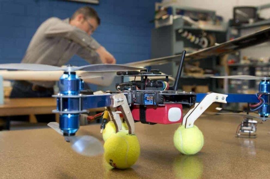
Jack Langelaan’s lab in the basement of Hammond Building is a model airplane builder’s dream.
In one room, graduate students Nathan Depenbusch and John Bird test algorithms on commercial flight simulators: Pilot’s eye views of checkered green landscapes roll past on banked computer screens. In the other room, a half dozen small planes and a couple of tiny helicopters sit waiting in various stages of deconstruction.
Langelaan, an associate professor of aerospace engineering at Penn State, is clearly in his element. He skirts past a wing assembly and picks up a smart phone-sized autopilot computer, offering it on his palm for inspection.
Autonomous vehicles, he calls them, or robotic gliders. Others call them drones. In recent years, these vehicles have gained attention, and notoriety, for their use by the military. Recently, Jeff Bezos of the online giant Amazon floated the idea that his company might one day use drones to deliver packages. Langelaan and others see many additional possibilities, for civil pursuits ranging from crop surveys to low-altitude meteorology.
According to Langelaan, fulfilling these visions will require developing planes that can think, or at least react, for themselves. The aim is to more closely mimic the aerial performance of birds.
“If you go back to the early days of flight, people have always been looking at birds and trying to figure out how they do it,” Langelaan says. He cites Lord Rayleigh, the British physicist who described the flight of the albatross in the journal Nature way back in 1883. “There is a lot of energy in the atmosphere,” Langelaan says. “Birds have figured out how to exploit it.”
The albatross does so by a technique called dynamic soaring, taking advantage of vertical wind shear — the difference in wind speed with changing altitude — to stay aloft for days and fly for thousands of miles over open ocean while hardly flapping its wings.
In the protected troughs between mid-ocean waves, Langelaan explains, the air is calm. Starting here under its own power, the albatross climbs to the top of a wave and above it, where the increasing headwind boosts its speed in relation to the air. Then, turning, it dives back down, again using the change in wind velocity to increase its airspeed.
“Radio controlled airplane pilots do a somewhat more extreme version of this,” he says. “They go to a spot where there’s a hill, and a wind blowing. Below the top of the hill on the downwind side there’s a dead zone, where there’s no wind. By flying a repeated loop across this shear boundary layer, they build up tremendous speed. The current world record is close to 500 miles per hour.”
Langelaan is currently working with colleagues at Lehigh University on a project to make dynamic soaring autonomous. “Our part is, given data that we can measure from the airplane, to build up a computer map of what the wind field looks like, so that we know the wind velocity as it changes,” he says. “Then we can use that information to figure out the best way to fly.”
Mapping on the fly
The other avian technique that Langelaan seeks to imitate is soaring on thermals, the way hawks and vultures do. A thermal occurs where the sun heats up the ground unevenly, resulting in hot spots that combine with an unstable atmosphere to create pockets of rising air. “A pretty good analogy is when you boil a pot of water, and bubbles form on the bottom first, then start to rise,” he explains.
Hawks enter thermals and are borne up on them, circling around to repeat the process and remain aloft. “Human glider pilots do the same thing,” Langelaan says. Human pilots, and probably birds too, know to look for the cumulus clouds that typically form above thermals.
For a robot plane, however, this is no easy task. In theory, a designer could place a video camera aboard and train a computer to recognize cumulus clouds, or mount an infrared camera to search for hot spots on the ground. “The problem is neither of these ideas works very well,” Langelaan says. “So the way you do it is you just fly along and hope you blunder into a thermal.
“As it turns out, there are lots of thermals out there,” he adds. “For the small planes that we’re flying, they don’t need to be very big.”
Still, to improve their chances, Langelaan is working on deploying planes in flocks whose individual members can communicate, sharing information on the locations of thermals as soon as they are discovered. “They all cooperate, so we build up a dynamic map of the immediate area,” he explains. “This way they can basically stay in the air as long as the sun is shining.”
Mapping on the fly is equally essential to avoiding the obstacles frequently encountered in low altitude flight, including trees, ridges and tall buildings. That means fitting planes both with sensors that can detect those obstacles and with autopilot computers that can process and react to sensor data in real-time.
Once perfected, Langelaan says, autonomous vehicles will have many uses. Drones are already being employed for so-called precision agriculture, flying over farmer’s fields fitted with cameras that can pinpoint areas in need of pesticide treatment or fertilizer. They could also be valuable tools for research. He is currently working with Penn State meteorology faculty to develop a plane that could gather data in the convective boundary layer, the poorly understood and hard-to-survey region where thunderstorms and tornadoes originate.
“We’re really hoping to get that off the ground,” Langelaan says. “The neat thing is that a lot of the instrumentation you’d need we’ll already have on board.”
Adapted from a news release issued by Penn State


