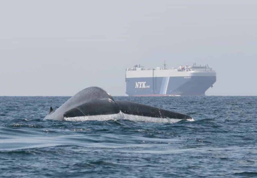
A comprehensive new analysis reveals that shipping routes overlap with nearly all whale habitats worldwide, yet only 7% of high-risk areas have protective measures in place. The study suggests that expanding protection to just 2.6% of ocean surface could significantly reduce fatal collisions.
Published in Science | Estimated reading time: 6 minutes
In an era where maritime shipping continues to expand rapidly, whales face an increasing threat from vessel collisions across the world’s oceans. By analyzing 435,000 whale locations and tracking data from nearly 176,000 large vessels, researchers have created the first global map of whale-ship collision risk, revealing both the scale of the threat and potential solutions.
The study focused on four species particularly vulnerable to ship strikes: blue whales, fin whales, humpback whales, and sperm whales. Within each species’ range, shipping traffic is staggering – vessels travel the equivalent distance of more than 4,600 round trips to the moon annually for most species.
While coastal areas show the highest concentration of collision risks, the threat extends far beyond shorelines. “Ship-strike risk is high anywhere that shipping routes intersect with key habitat or migratory corridors,” the researchers note. The Indian Ocean, western North Pacific, and Mediterranean emerged as particular hotspots, containing the highest percentages of risk areas across all species.
Perhaps most concerning is the lack of protective measures in high-risk areas. Less than 7% of identified hotspots have any management strategies in place to reduce collisions. However, the researchers found that expanding protective measures to just 2.6% of the ocean’s surface could significantly reduce fatal collisions in all high-risk areas.
The study also revealed that 98% of high-risk areas fall within countries’ exclusive economic zones, meaning individual nations have the power to implement protective measures. This suggests that solutions could be achieved through national regulations rather than requiring complex international agreements.
As global shipping is projected to triple by 2050, the need for action becomes increasingly urgent. The researchers emphasize that while ship strikes pose a serious threat to whale populations, it’s a “ubiquitous yet solvable conservation challenge.” Solutions like reducing vessel speeds and rerouting ships around crucial whale habitats could make a significant difference.
The findings come at a crucial time, as world leaders commit to protecting 30% of the ocean by 2030. Understanding where whales face the greatest risks from shipping could help ensure these protected areas are strategically placed to safeguard these ocean giants for future generations.
Glossary:
- Exclusive Economic Zone (EEZ)
- An area of ocean extending up to 200 nautical miles from a country’s coast where that nation has special rights regarding marine resources and their use.
- Ship Strike
- A collision between a vessel and a whale, often resulting in serious injury or death to the animal.
- Hotspot
- In this study, areas representing the top 1% of ship-strike risk where whale habitats and shipping routes overlap significantly.
What percentage of whale habitats overlap with shipping routes?
92% of whale habitats overlap with shipping routes worldwide.
What proportion of high-risk areas currently have protective measures in place?
Less than 7% of high-risk areas have management strategies to reduce collisions.
What percentage of ocean surface would need protection to cover all high-risk areas?
Expanding protective measures to 2.6% of the ocean’s surface could reduce fatal collisions in all high-risk areas.
Which regions showed the highest percentages of risk hotspots?
The Indian Ocean, western North Pacific Ocean, and Mediterranean contained the highest percentages of risk hotspots across all species.
Enjoy this story? Subscribe to our newsletter


