The National Weather Service reported the high temperature at Ronald Reagan Washington National Airport in Washington, D.C. on March 11 hit 72. On March 12, the high topped out at 69 before a powerful cold front moved in. On March 13 at 12 p.m. EDT the airport reported 28F with northwesterly winds gusting to 37 mph. That made the wind chill feel like 13F at lunchtime. That’s a 59 degree difference from the way it felt in the city two days before.
Further north, the storm also brought snow with the gusty winds and generated Blizzard Warnings to Buffalo, N.Y. on March 12 where heavy snow fell totaling 13.8 inches. The National Weather Service in Buffalo reported the highest sustained wind speed was 36 mph, and highest winds gusted to 47 mph. According to the National Weather Service, Buffalo’s snowy winter has dropped 120.6 inches of snow, or 10 feet, 6 inches for the season.
In a short range public discussion, NOAA’s National Weather Service Weather Prediction Center in College Park Md. noted on March 13 at 4:33 a.m. EDT: Conditions will gradually clear out across the Northeast on Thursday as the winter storm that dumped over a foot of snow over interior New England tracks farther up the Eastern Seaboard. Strong northwesterly winds behind the storm will make for a blustery day across the Northeast and Mid-Atlantic States… but winds should begin to diminish and temperatures will start to rebound once the storm lifts into the Canadian Maritimes on Friday.
NOAA’s GOES-East satellite sits in a fixed orbit in space capturing visible and infrared imagery of all weather over the eastern U.S. and Atlantic Ocean.
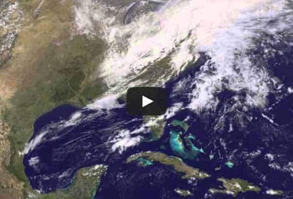
Imagery from March 11 at 15:45 UTC/11:45 a.m. EDT to March 13 at 16:01 UTC/12:01 p.m. EDT captured by NOAA’s GOES-East or GOES-13 satellite was compiled into a 21 second video made by NASA/NOAA’s GOES Project at NASA’s Goddard Space Flight Center in Greenbelt, Md.
To create the video and imagery, NASA/NOAA’s GOES Project takes the cloud data from NOAA’s GOES-East satellite and overlays it on a true-color image of land and ocean created by data from the Moderate Resolution Imaging Spectroradiometer, or MODIS, instrument that flies aboard NASA’s Aqua and Terra satellites. Together, those data created the entire picture of the storm and show its movement. After the storm system passes, the snow on the ground becomes visible.
GOES satellites provide the kind of continuous monitoring necessary for intensive data analysis. Geostationary describes an orbit in which a satellite is always in the same position with respect to the rotating Earth. This allows GOES to hover continuously over one position on Earth’s surface, appearing stationary. As a result, GOES provide a constant vigil for the atmospheric “triggers” for severe weather conditions such as tornadoes, flash floods, hail storms and hurricanes.
For updated information about the storm system, visit NOAA’s NWS website: www.weather.gov
For more information about GOES satellites, visit: www.goes.noaa.gov/ or goes.gsfc.nasa.gov/


