joint typhoon warning center
NASA infrared satellite data see an intensifying Tropical Storm Dianne
Infrared satellite data from NASA’s Aqua satellite reveal that Tropical Storm Dianne is getting organized off the coast of Western Australia today.
NASA’s Atmospheric Infrared Sounder (AIRS) infrared imagery suggests that Dianne’s center of c…
NASA satellite sees Tropical Storm Bingiza hugging the western Madagascar coastline
Infrared satellite data from NASA is showing some strong thunderstorms over west-central Madagascar today as Tropical Storm Bingiza continues to hug the western coast of the island nation.
The Atmospheric Infrared Sounder (AIRS) instrument tha…
NASA sees tropical cyclone double-trouble for Australia
NASA’s Aqua satellite captured an infrared image today of tropical cyclones affecting Australia in the western and northern areas of the country. Newly formed Tropical Storm Carlos is bringing heavy rains and gusty winds to Darwin and the Northe…
NASA Satellite sees most of Cyclone Bingiza’s rainfall over Mozambique Channel
Infrared data from NASA’s AIRS instrument revealed that the low level center of Cyclone Bingiza was still over land in western Madagascar this morning, but the bulk of its rainfall was over the Mozambique Channel.
When NASA’s Aqua satellite fl…
NASA Satellite sees two ‘tropical fists’ threatening Australia
Australia is getting hit with two “tropical fists” as NASA satellites watch two low pressure areas develop near the Northern Territory and Western Australia. System 99S is currently strengthening near Darwin, Australia and another low pressure a…
NASA Satellite catches a tropical cyclone forming near Darwin, Australia
NASA’s Aqua satellite captured a low pressure area known as System 99S that appears to be strengthening very close to Darwin, Australia. Aqua satellite data indicated that the strongest thunderstorms were over the Timor Sea on Feb. 15.
System …
2 NASA satellites see a newborn tropical storm near Madagascar
Forecasters at the Joint Typhoon Warning Center were keeping a close eye on a low pressure area known as System 94S yesterday, and satellite data helped confirm that today it has strengthened into Tropical Storm Bingiza.
The Moderate Resolution…
NASA’s Aqua Satellite sees Tropical Depression Anthony heading toward Australia
NASA’s Aqua Satellite captured a visible image of the former Tropical Storm Anthony, now weakened to a tropical depression, but forecasters aren’t counting Anthony out yet. Despite its weakened condition Anthony continues to move west toward Q…
NASA’s Aqua Satellite sees tropical potential in system 94P
The last thing that Queensland, Australia needs is more rainfall after the record-breaking flooding that has been occurring there in the last two months. Now, NASA’s Aqua satellite has noticed a low pressure area with signs of tropical developme…
NASA watching Jal’s remnants in the Arabian Sea for possible rebirth
Infrared and visible imagery from NASA’s Aqua satellite today hinted that the low pressure area formerly known as Cyclone Jal may have new life soon. Jal has emerged into the warm waters of the Arabian Sea after crossing India this past weekend.
…
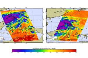
NASA satellite sees Tropical Storm Kompasu transitioning over Korea and China
NASA’s Terra satellite captured the changing Tropical Storm Kompasu over Korea and China very early today, as it makes its way east to northern Japan. It is becoming extratropical.
The Moderate Resolution Imaging Spectroradiometer (MODIS) i…

