

Fire moves fast. Now, an AI tool promises to map the fuels that feed it, fast enough to matter.
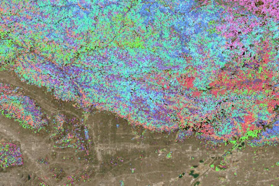
Researchers at UCLA Samueli and collaborators report FuelVision, an AI wildfire fuel mapping system that fuses satellite imagery with machine learning to deliver near real time, landscape scale fuel maps. Validated on California’s 2021 Dixie and Caldor fires, FuelVision reached about 77 percent mapping accuracy, close to official fuels datasets and quick enough to inform planning. The study appears in the International Journal of Applied Earth Observation and Geoinformation and points to a practical path for nationwide wildfire preparedness.
Key Takeaways
- Validated on the 2021 Dixie and Caldor wildfires, FuelVision’s predictions closely matched actual fuels maps, with 77 percent accuracy.
- Works autonomously with widely available satellite data, without requiring ground surveys.
- Designed for rapid, on demand mapping and readily adaptable to forested regions nationwide.
- Built with multimodal data fusion and an ensemble of AI models that include deep learning and gradient boosting.
Why It Matters
Wildfire behavior depends on fuels. Crews plan tactics, model spread, and stage evacuations based on where grass, shrubs, and timber litter form continuous beds. Those fuels change over seasons and after disturbances. A living fuel map, updated quickly and consistently, can tighten the loop between risk forecasts and action. What could it mean for communities if responders had that map before red flag winds arrived?
How FuelVision Works
FuelVision blends optical and radar views of the landscape with terrain context to recognize fuel types at 30 meter resolution. The team combined Landsat 8 optical indices, C band Sentinel 1 SAR features, L band PALSAR metrics, and slope and elevation into a single feature set. An ensemble pipeline, stacked across multiple model families, learns the 40 class Scott and Burgan fuel models from U.S. Forest Service Forest Inventory and Analysis plot labels.
Because field labels are limited and imbalanced, the researchers expanded training data two ways. First, they propagated labels to nearby pixels with similar spectral signatures. Second, they used generative adversarial networks to synthesize additional training rows, improving coverage of underrepresented fuel classes. Together, these steps pushed accuracy toward the 0.77 level reported in testing.
What The Tests Show
To check real world utility, the team generated fuels maps for the Dixie and Caldor fire regions and compared results to high resolution imagery and reference products. Patterns of shrub, timber litter, and timber understory matched visible vegetation structure, and misclassifications clustered in places where classes are hard to separate, such as low shrubs versus timber understory. The model also outputs pixel wise probabilities, which helped flag uncertain areas that overlapped with non burnable surfaces and recent timber harvests.
“FuelVision can help anticipate where fires might spread and how to prepare,” said Ertugrul Taciroglu, study corresponding author and a professor of civil and environmental engineering at UCLA Samueli. “It’s versatile, easily adaptable and can help agencies globally with both organizing emergency response and developing long-term risk assessment and fire mitigation strategies.”
From Lab To Line
The researchers plan two access paths. A Python interface will let users with basic coding skills generate their own fuel maps from satellite inputs. For teams that prefer a service model, the group will offer on demand fuel map production. Either route keeps the barrier low for local agencies, utilities, and land managers who need timely, comparable fuel layers to plug into spread models and resource plans.
Context And Caveats
Annual national fuels products like LANDFIRE are critical for planning, yet they update on slower cycles and blend expert rules with machine learning. FuelVision complements those baselines with rapid refresh and explicit uncertainty. As with all spaceborne approaches, some fine scale fuels can be hard to resolve, and performance outside forested lands was handled post processing rather than via training data. The authors emphasize that probability layers can steer quality control and pinpoint where field verification would help the most.
What Comes Next
Because FuelVision draws on global satellite streams, the same workflow can extend to other regions and fire regimes. That opens doors for preseason planning, smoke and emissions modeling, and targeted fuels treatments. The authors note that integrating additional field datasets and refining class boundaries, especially among similar shrub and understory types, could further improve accuracy without slowing delivery.
Study Details
Title: FUELVISION: A multimodal data fusion and multimodel ensemble algorithm for wildfire fuels mapping
Authors: Riyaaz Uddien Shaik, Mohamad Alipour, Eric Rowell, Bharathan Balaji, Adam Watts, Ertugrul Taciroglu
Affiliations: UCLA Samueli School of Engineering and collaborators
Funding: National Science Foundation, Edison International, Science Hub for Humanity and Artificial Intelligence, a collaboration between UCLA Samueli and Amazon
Journal: International Journal of Applied Earth Observation and Geoinformation