

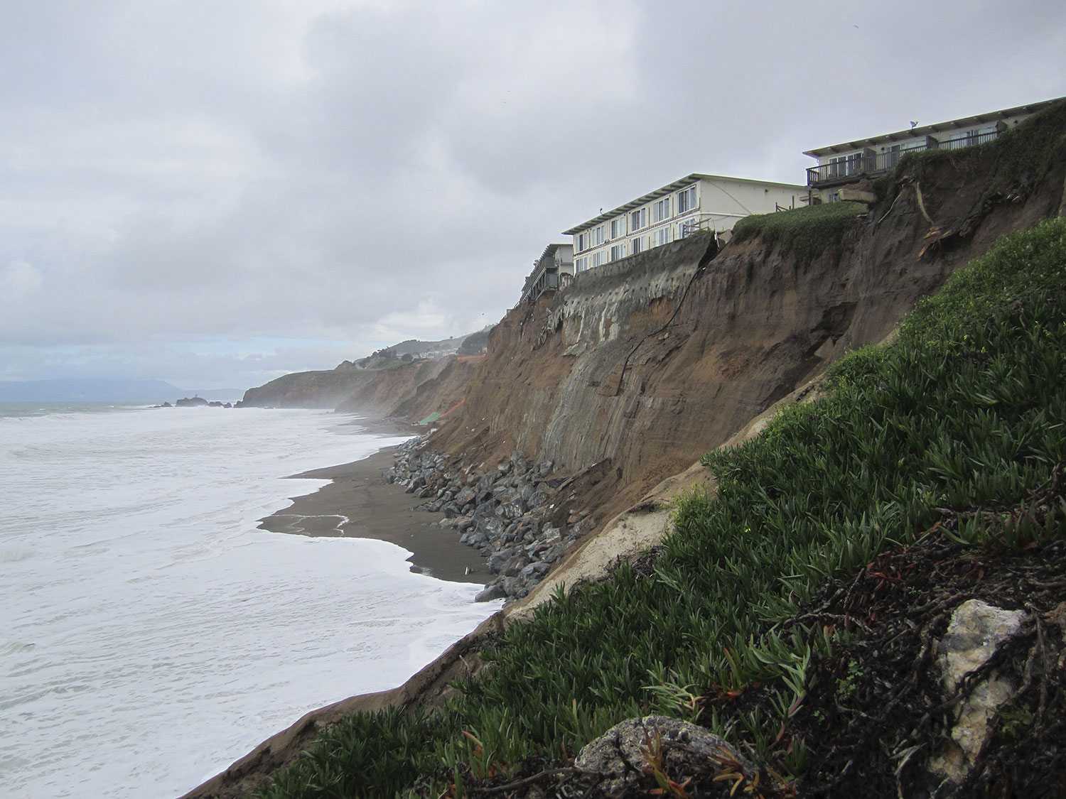
Ten houses along Beach Road at Capistrano Beach in Dana Point now carry red tags, and seven more carry yellow ones — the count published by the City of Dana Point in its Beach Road updates, last revised at noon on 14 September 2026. A red tag means the structure is unsafe to occupy. A yellow tag means restricted use. The tags followed a fortnight in which high tides and swells from Hurricane Marie chewed out the sand beneath the oceanfront row. The city says it was first called out on 28 August, when a residential deck was destroyed; inspectors red-tagged that house the same night after finding its slab foundation undermined.
Four days after Orange County declared its own emergency, the state followed. On 21 September, Governor Gavin Newsom proclaimed a statewide state of emergency for the developing 2026–2027 El Niño — not in response to a single storm, but to stage equipment, people and permits ahead of a winter that could be unusually wet and unusually rough at the shoreline.
The tags on Beach Road, and the emergencies stacked behind them
Dana Point’s Director of Emergency Services proclaimed a local emergency on 9 September over coastal flooding caused by Hurricane Marie, and the City Council unanimously approved the proclamation on 15 September. Property owners have been installing emergency boulder revetment — rock armour laid on the beach side of the homes — using private contractors working under emergency coastal development permits issued by the California Coastal Commission.
Beach Road is a jurisdictional knot, which is part of why the response has involved so many letterheads. As the city’s own statement sets out, the road sits inside the Dana Point city boundary but is also governed by the Capistrano Bay Community Services District. Orange County maintains the public beaches immediately north and south. The State holds jurisdiction over the beach seaward of the homes themselves. A single wave overtopping a single seawall can therefore be four agencies’ problem at once.
On 17 September, the County of Orange proclaimed its own local emergency for ongoing coastal impacts related to Hurricane Marie, following earlier declarations in Dana Point, Laguna Beach and San Clemente. The county acted in its capacity as the Operational Area, at the request of those coastal cities, and its release cited both Marie’s damage and concern about further El Niño-related weather through the coming winter. Its Operational Area Emergency Operations Center remained activated at a low level.
None of this yet answers the question owners on Beach Road are asking, which is what happens to a red-tagged house when the sand does not come back before December. That question is precisely where the state proclamation points.
What a very strong El Niño does to a coastline
El Niño is the warm phase of a cycle in the tropical Pacific: sea surface temperatures in the central and eastern Pacific run above average, the atmosphere responds, and the storm track over North America shifts. For California, the practical consequence is often stronger and more frequent winter storms, and — less discussed but more damaging to property — higher water.
Warm water expands. Elevated regional sea level during a strong El Niño raises the baseline on which tides and waves sit, so an ordinary king tide arrives higher than it would otherwise, and a large swell breaks further up the beach. Add storm surge and the erosion budget for a winter can be spent in a weekend. The proclamation itself names elevated baseline coastal water levels, combined with high tides and large waves, as a driver of coastal flooding and beach and bluff erosion.
The forecast numbers in the signed proclamation come from NOAA’s Climate Prediction Center and its 13 August diagnostic report: greater than a 90 per cent chance of a very strong El Niño through autumn and winter 2026–27, and a 69 per cent chance of historic strength over October to December 2026 — defined by a three-month Relative Oceanic Niño Index exceeding every prior event in the record back to 1950. The governor’s office announcement the same day put the odds of historic strength higher, at 75 per cent.
The state also says California has already felt effects attributed to this El Niño, including significant coastal flooding. The governor’s announcement spells out the mechanism it has in mind: Kelvin waves raising sea levels, and offshore Pacific hurricanes, fuelled by warm eastern Pacific water, driving large waves onto the coast. That is the connective tissue between Marie’s swell and the broader season — but it is worth being careful with. Neither the proclamation nor the announcement names Hurricane Marie. Warm water is fuel, not cause, and the defensible framing is that Beach Road was hit by a storm arriving into an ocean state that is already elevated and expected to stay that way.
Sandbags, rock and a five-day permit clock
The interesting part of the 21 September order is how much of it is logistics rather than rhetoric. It directs the Governor’s Office of Emergency Services to coordinate the statewide response. It tells the Department of Water Resources to procure and pre-position flood-fight supplies — sandbags, pumps, riprap and other rock — before they are needed rather than after. Caltrans is to plan the pre-positioning of traffic-control, road-closure and snow-removal equipment along the highways most at risk. The National Guard is to undertake readiness planning.
For coastal communities the most consequential instruction may be the one aimed at the Coastal Commission. Under the order, the Commission must notify applicants of any incomplete items within five days of receiving a permit application, and must act on emergency permit requests within 24 hours where there is an urgent need tied to the emergency. Beach Road’s boulder revetment went in before the proclamation, under emergency permits that the city says Commission staff were already reviewing and approving over weekends and after hours. If the winter brings the kind of storms a very strong El Niño can deliver, many other stretches of the California coast could be queuing at the same window, and the difference between a 24-hour turnaround and a multi-week one is measured in foundations.
The order also directs expanded multilingual preparedness communications. The proclamation lists low-income communities, farmworker families, rural residents and people experiencing homelessness among those who may face disproportionate risk — a reminder that the people most exposed to flooding in California are not, as a rule, the people who own houses on Beach Road.
What the state has done, in short, is move its resources forward in time. Whether ten red tags at Capistrano Beach turn out to be the season’s opening line or its high-water mark will be settled by tides between now and March.