

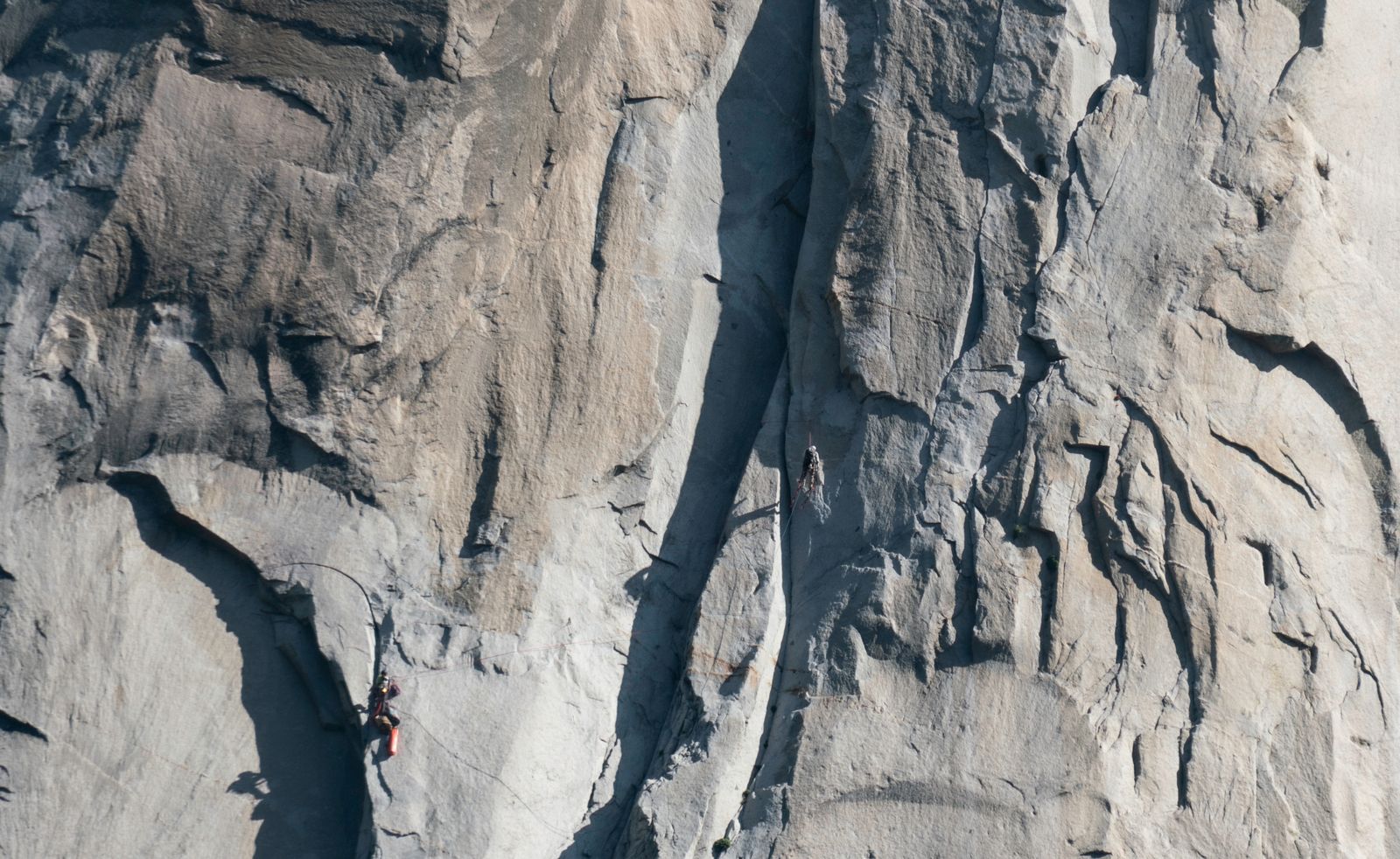
Mount Thor rises above the tundra of Baffin Island as an immense wall of granite. According to Guinness World Records, its west face has a vertical drop of 1,250 metres and an average angle of 105 degrees, placing it about 15 degrees beyond vertical.
The frequently repeated claim that a fall from the top would last roughly 26 seconds needs one important qualification. The estimate cited by IFLScience describes a person falling with their arms spread and approaching terminal velocity. It is not a measured fall time, and it cannot automatically be applied to a stone, whose speed through air would depend on its mass, size, shape, and orientation.
Mount Thor stands in Auyuittuq National Park on southeastern Baffin Island in Nunavut. Parks Canada describes the park as a landscape of glaciers, steep fiords, river valleys, and the towering peaks surrounding Akshayuk Pass.
What the geometry actually means
A perfectly vertical cliff has a face angle of 90 degrees. Mount Thor’s quoted average of 105 degrees means that the west face, taken as a whole, extends beyond that vertical line.
If a 1,250-metre wall maintained an angle of 15 degrees beyond vertical from top to bottom, basic trigonometry would give it a horizontal displacement of about 335 metres. That is a useful illustration, but it should not be mistaken for a survey of Mount Thor’s actual profile.
The wall is not one uniformly tilted slab. Eric Brand’s account of the 1985 direct west-face ascent in the American Alpine Journal describes approximately 2,000 feet of vertical terrain followed by an upper 1,500-foot section averaging 105 degrees. The famous angle therefore describes a major section of the route, not necessarily every metre of the entire drop.
Even so, the mountain’s geometry allows an unusually long path through open air. The 26-second figure translates that geometry into a human timescale, but it remains an estimate based on assumptions about drag and body position rather than a stopwatch measurement.
How the wall got there
Mount Thor belongs to the ancient geological terrain of the Cumberland Peninsula. A Geological Survey of Canada map describes the region as containing Archean basement rocks roughly 2.97 to 2.77 billion years old, along with younger Paleoproterozoic formations. That regional history is more precise than simply calling every part of the mountain 3.5 billion years old.
The area’s present landscape reflects extensive glacial shaping. Ice moving through the valleys excavated and steepened the terrain, leaving the sharp peaks, broad troughs, exposed rock, and hanging walls now associated with Auyuittuq.
Weathering and rockfall continue to alter exposed cliffs, but there is no reliable basis here for assigning Mount Thor a specific rate of height loss per century. Geological change at a particular cliff is irregular and depends on fractures, freeze-thaw conditions, and individual rockfall events.
The direct west face took 33 days
Mount Thor had been climbed before the celebrated 1985 expedition. The American Alpine Journal records that a Japanese team reached the summit in 1984 by following the west face and then the north ridge, avoiding the main overhanging headwall.
In May and June 1985, John Bagley, Tom Bepler, Eric Brand, and Earl Redfern attempted the direct west face. Their primary expedition account says the climb took 33 days after they left their fixed lines. The route involved 36 pitches and approximately 1,000 pounds of food and equipment.
The climbers faced storms, severe cold, difficult hauling, and persistent rockfall. Much of the upper headwall required direct aid climbing, meaning the team depended on equipment placed in the rock to make upward progress rather than climbing entirely by gripping natural features.
The danger beyond the wall
The height and overhang have also made Mount Thor well known in accounts of BASE jumping. A Condé Nast Traveler feature reported that jumping is prohibited in Auyuittuq because of the difficulty of reaching and rescuing people in the area.
The danger is not limited to the cliff itself. Parks Canada warns visitors about limited rescue capability, rapidly changing weather, high winds, difficult river crossings, rockfall, avalanches, glaciers, and polar bears. Visitors are expected to be self-reliant and prepared for delays.
The 26-second estimate is therefore best understood as a way to communicate scale, not as an invitation to test the calculation. Conditions on the mountain and throughout the park can make even ordinary travel difficult, while emergency help may be far away.
Why the number sticks
Twenty-six seconds is memorable because it converts an abstract height into an interval people can imagine. It is long enough for the scale of the cliff to feel real in a way that 1,250 metres may not.
The apparent precision can still mislead. In a vacuum, an object would cover 1,250 metres in about 16 seconds. Air resistance lengthens the descent, but the amount depends on the falling object’s aerodynamic properties. A spread-out human body experiences much more drag relative to its mass than a compact, dense stone.
That is why the popular estimate cannot be treated as a universal answer for anything dropped from the summit. It is a simplified scenario involving a human body, terminal velocity, and a clear path through the air.
What a wall this size does to scale
Mount Thor’s surroundings offer few familiar reference points. The treeless valley, broad talus slopes, glaciers, and enormous rock faces can make distances difficult to judge from photographs.
The west face’s documented combination of vertical and overhanging sections creates the impression that its upper wall leans toward anyone looking from below. That visual effect corresponds to real geometry, even though the commonly cited 105-degree figure does not describe a perfectly uniform slope from summit to base.
The distinction makes the mountain more interesting, not less. Its record is not based on an idealised smooth wall. It comes from the scale and average angle of a complicated natural face shaped by ancient rock, moving ice, fractures, and continuing weathering.
The wall in the Arctic light
Mount Thor lies about 16 miles north of the Arctic Circle, according to the 1985 expedition account. During the second week of May, Brand wrote that the climbers had daylight 24 hours a day and sometimes worked during the cooler evening hours to reduce their exposure to falling rock and ice.
The low Arctic sun changes the appearance of the granite as it moves around the horizon. Shadows shift across the vertical lower wall and the overhanging headwall, making the face look different as the light changes even when the sun does not disappear.
The wall will continue changing through weathering, freeze-thaw action, and rockfall, but not according to a smooth timetable. Mount Thor’s most extraordinary feature is not that it remains motionless. It is that geological change produced a face so large and steep that a human fall through its open air can be described in tens of seconds rather than moments.