

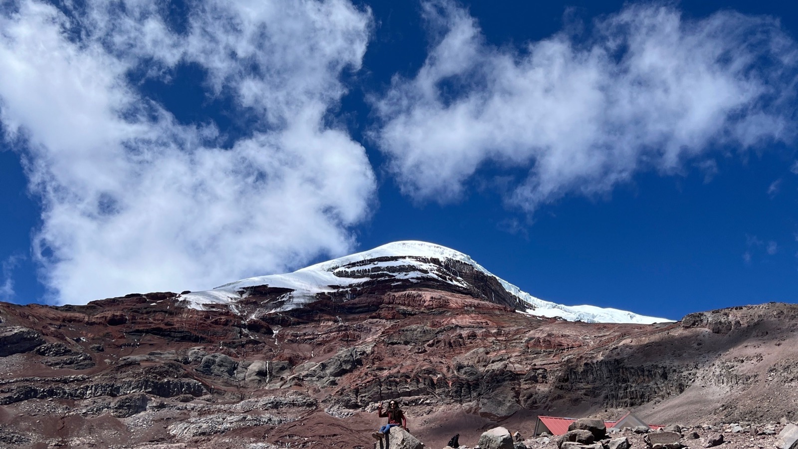
Mount Everest keeps its most famous record. At 8,848.86 metres above mean sea level, its summit has the highest elevation on Earth. But change the starting point from sea level to the centre of the planet and an entirely different mountain wins.
Chimborazo, a glacier-capped volcano in Ecuador, rises only 6,263.47 metres above sea level. Its summit is nevertheless more than two kilometres farther from Earth’s centre than Everest’s. The apparent contradiction is not a loophole or a new discovery. It is a clean demonstration that the word “highest” has no meaning until a reference surface is specified.
The two measurements answer different questions
Elevation asks how far a point stands above a reference close to mean sea level. By that measure, Everest is plainly ahead. Nepal and China announced a joint official height of 8,848.86 metres in 2020. The modern Franco-Ecuadorian survey of Chimborazo put its summit elevation at 6,263.47 metres. Everest therefore has an elevation advantage of about 2,585 metres.
Geocentric distance asks something else: how far is the summit from Earth’s centre of mass? A 2016 measurement reported by France’s Geoazur laboratory placed Chimborazo’s summit 6,384,415.98 metres from the centre. Estimates for Everest are around 6,382.3 kilometres.
Depending on the elevation data and Earth model used, published differences vary slightly. The US National Ocean Service gives a margin of more than 2,072 metres, while calculations using other datasets put it somewhat higher. The exact margin is model-sensitive, but the result is not: Chimborazo’s summit is more than two kilometres farther out.
Earth is wider around the equator
The familiar classroom globe is an excellent approximation, but Earth is not a perfect sphere. Rotation makes the planet bulge around its middle and flatten slightly at the poles. Geodesists describe the simplified shape as an oblate ellipsoid.
The scale of that bulge is easy to underestimate. According to the National Oceanic and Atmospheric Administration, Earth’s equatorial radius is about 6,378.1 kilometres, while its polar radius is about 6,356.8 kilometres. That is a difference of roughly 21.3 kilometres, far larger than the 2.6-kilometre elevation advantage Everest holds over Chimborazo.
Location decides how much of the bulge a mountain receives. Chimborazo stands at roughly 1.5 degrees south latitude, almost on the equator. Everest is close to 28 degrees north. Both summits sit on the same oblate planet, but the ground beneath Chimborazo begins much farther from the centre.
The equatorial advantage does not simply add the full 21.3 kilometres to Chimborazo. Everest is not at the pole, and a summit’s geocentric distance depends on latitude, elevation and the adopted ellipsoid. Still, the bulge supplies enough extra radius to erase Everest’s elevation lead and leave more than two kilometres to spare.
Sea level is not a smooth shell either
Even “above sea level” is more sophisticated than it sounds. The oceans are shaped by Earth’s gravity, rotation, tides, currents and uneven distribution of mass. If the water could settle without winds and currents, its idealized surface would follow an equal-gravity surface called the geoid.
The geoid is irregular, so surveyors often use a mathematically smooth reference ellipsoid for calculations and connect it to the gravity-based height system. The US National Geodetic Survey explains how geopotential surfaces underpin modern height measurements. GPS, meanwhile, naturally reports positions relative to an ellipsoid before those positions are transformed into more familiar elevations.
This distinction matters because elevation and distance from the centre are not interchangeable. Everest’s elevation measures how far its summit lies above the relevant sea-level reference. Chimborazo’s record compares a summit position with a point inside the planet. Both measurements are valid. They have different zeroes.
A GPS receiver helped settle Chimborazo’s number
In February 2016, a Franco-Ecuadorian team carried survey equipment to Chimborazo’s summit. Ecuador’s Geophysical Institute described how the group placed a precision GPS receiver at the top, supported by observations at reference stations below.
The work was partly a modern echo of French geodesic expeditions to Ecuador in the 18th century, when scientists travelled there to test whether Earth was flattened at the poles. In the modern survey, satellite positioning and updated geodetic models produced the 6,384,415.98-metre centre-to-summit result.
That precision can look more absolute than it is. A coordinate can be measured very precisely within a defined reference frame, while comparisons quoted for different mountains may still use rounded summit elevations, different geoid models or slightly different coordinates for the highest point. That is why responsible sources do not all print the same difference to the last metre.
The useful conclusion survives those choices. A person standing on Chimborazo is standing on the fixed land surface farthest from Earth’s centre, even though that person remains about 2.6 vertical kilometres below an Everest climber when both elevations are measured from sea level.
There are at least three sensible mountain records
Everest is highest above mean sea level. Chimborazo has the summit farthest from Earth’s centre. Mauna Kea is often called the tallest mountain from base to summit because most of its roughly 10.2-kilometre rise begins beneath the Pacific. NOAA’s overview places all three records side by side.
Science Blog has visited this measurement puzzle before. Lachlan Brown’s earlier article explained why Chimborazo sits farther from the centre than Everest, and another explored how Everest, Mauna Kea and Chimborazo can each lead under a different definition. The geodesy is the thread connecting those answers.
Calling Chimborazo the point “closest to outer space” is popular shorthand, but it can mislead. Space has no dome centred neatly above one mountain, and Chimborazo is not permanently the closest point to the Sun as Earth rotates and travels around its orbit. The defensible record is narrower and more interesting: its summit is the farthest point on Earth’s solid surface from Earth’s centre.
So Everest has not been demoted. It still has the greatest elevation above mean sea level. Chimborazo simply exposes the hidden assumption inside that familiar ranking. Change the baseline, and the answer changes with it.