

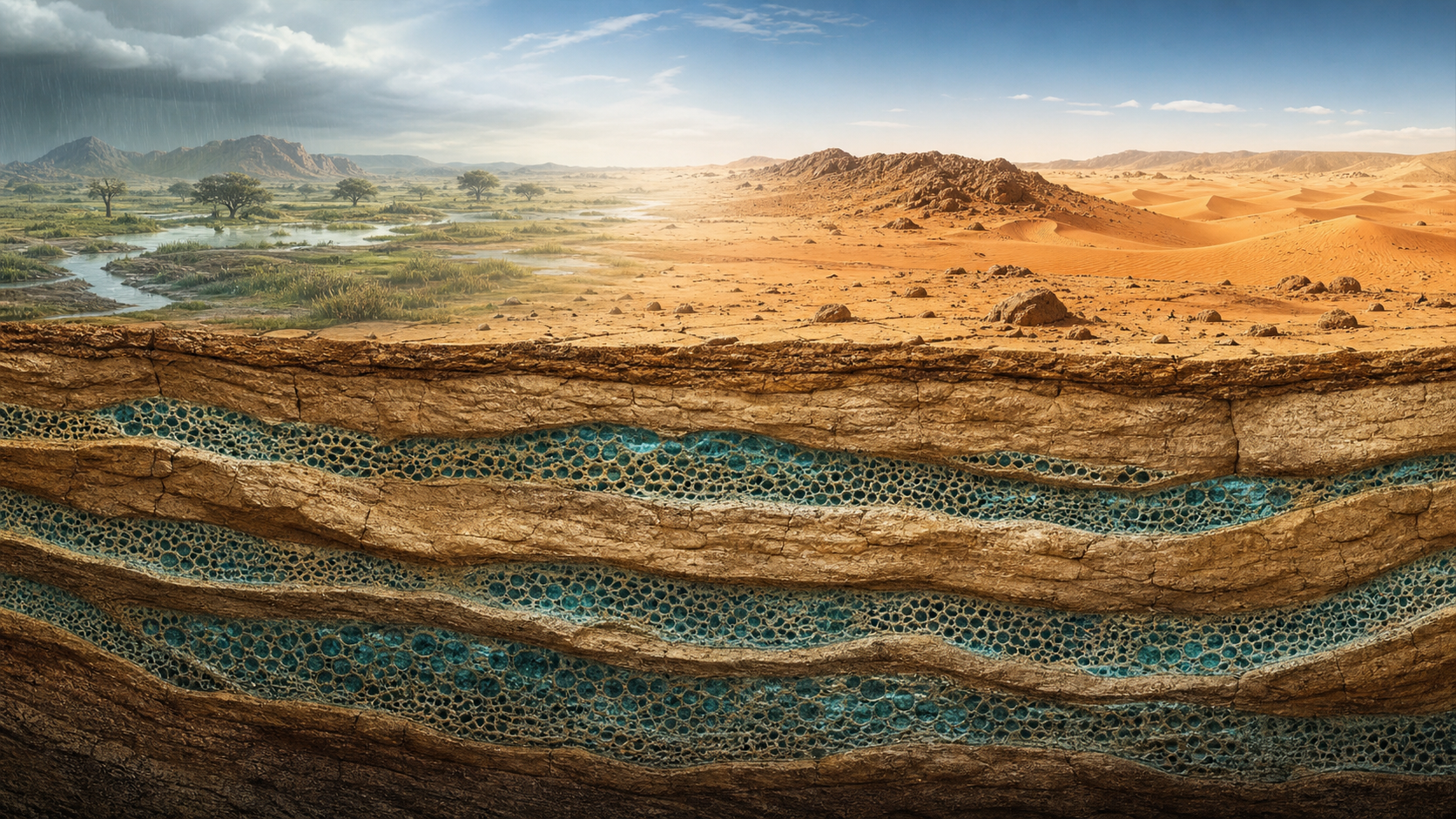
Under the sand and rock of North Africa, water fills porous layers of sandstone across areas larger than many countries. Some of it entered the ground when rain crossed what is now the Sahara, then moved so slowly through the rock that it remained there through tens of thousands of dry years.
Calling this “an ocean’s worth” captures the scale, but not the geology. There is no single underground sea beneath the desert. The Sahara overlies several aquifer systems, and their water occupies pores and fractures in rock rather than a vast open chamber. The total is immense, but it is not comparable to the volume of Earth’s oceans.
The age is also more complicated than one lost green era. Different samples record different recharge episodes. Some are tens of thousands of years old; water from the deepest parts of the Nubian Aquifer has been dated to hundreds of thousands of years, in places approaching one million.
The reservoir is a layered archive of repeated wet periods.
The largest stores lie under North Africa
A continent-wide assessment published in Environmental Research Letters in 2012 estimated that Africa contains about 660,000 cubic kilometers of groundwater, with an uncertainty range from 360,000 to 1.75 million cubic kilometers. The study, led by Alan MacDonald of the British Geological Survey, found that the largest volumes occur in sedimentary aquifers beneath Libya, Algeria, Egypt and Sudan.
That figure covers all of Africa, not only the Sahara, and it estimates water held in the ground rather than water that could be recovered. Both distinctions matter. A map of storage is not a map of productive wells.
The best-known Saharan reserve is the Nubian Sandstone Aquifer System. It extends beneath Chad, Egypt, Libya and Sudan across roughly two million square kilometers. The International Atomic Energy Agency calls it the world’s largest known fossil-water aquifer system.
It is not the Sahara’s only major aquifer. Farther west, the North Western Sahara Aquifer System crosses Algeria, Tunisia and Libya. Other large basins sit beneath the western and central desert. Boundaries drawn on maps simplify formations that vary in depth, thickness, salinity and permeability.
The water is inside the rock
The word “aquifer” can suggest a buried lake.
Most groundwater looks nothing like that.
As the US Geological Survey explains, groundwater fills connected pores and fractures in sand, gravel and rock, much as water fills a sponge. Sandstone can preserve spaces between ancient sand grains. If those spaces connect, water can move through the formation and reach a well.
Porosity tells geologists how much empty space a rock contains. Permeability describes how readily water can move between those spaces. A thick layer may hold a large volume but release it too slowly for a high-yield well. Clay and shale layers can trap water under pressure, while faults can either open routes for flow or act as barriers.
This is why stored volume cannot be converted directly into a promise of supply. MacDonald’s team found that high-yielding boreholes were much less widespread than total storage might imply. Water may also be too deep, too salty, too remote or too expensive to pump.
Rain entered during several greener Saharas
North Africa has repeatedly shifted between arid and humid conditions. Changes in Earth’s orbit altered Northern Hemisphere summer sunlight, strengthening the African monsoon during favorable intervals and moving its rain belt north.
During these humid periods, water ran through river networks and soaked into exposed sandstone. A 2015 Nature Communications paper led by Charlotte Skonieczny used satellite radar to identify a 520-kilometer section of a buried river system in western Sahara. The authors concluded that the larger drainage system was reactivated during several humid episodes over the past 245,000 years.
The most recent African Humid Period lasted from roughly 14,700 to 5,500 years ago. Pollen and archaeological records indicate that woodland and grassland communities extended far north of their present ranges, supporting lakes, fish, crocodiles, elephants and human settlements.
“Forested” should not be read as a wall of rainforest from the Atlantic to the Nile. The green Sahara was a changing mosaic of grassland, wooded savanna, wetlands, rivers and lakes. Earlier humid phases could be wetter or differently distributed. The water below today’s desert accumulated during more than one of them.
Radioactive atoms work as clocks
Groundwater age means the time since rain entered the aquifer and stopped exchanging freely with the atmosphere. Hydrologists estimate it from dissolved chemicals and rare radioactive isotopes whose decay rates are known.
Radiocarbon is useful over tens of thousands of years. A 2020 study in Water led by Mustafa El-Rawy, for example, summarized Nubian groundwater age estimates of about 20,000 to 49,000 years. Dating very old water requires clocks that run longer.
In a 2004 Geophysical Research Letters paper, Neil Sturchio and colleagues measured krypton-81 and chlorine-36 in deep Nubian Aquifer samples. Their results showed that some groundwater had resided below the Sahara for up to about one million years. Krypton-81 is especially useful because it has a half-life of about 229,000 years and is distributed through the atmosphere before rain carries it underground.
These dates do not mean every liter in the aquifer is equally ancient. Water mixes, flow paths differ, and some margins receive limited modern recharge. Age generally increases along long regional paths away from recharge areas.
A huge reserve can still be depleted
Fossil groundwater is not renewable on the timescale of a farm, city or government. In the hyper-arid interior, present rainfall replaces little of what large wells remove. Pumping there is closer to mining a finite reserve than drawing from a river that returns each season.
The IAEA says growing demand and declining availability from other sources have placed the Nubian system under pressure. Chad, Egypt, Libya and Sudan have therefore developed a joint management framework because pumping in one country can affect a shared aquifer.
Even a vast system can experience local drawdown around well fields. Falling pressure can increase pumping costs, dry shallower wells and change the movement of saline water. The sheer total volume says little about how long a particular community’s borehole will remain usable.
The water beneath the Sahara is real, ancient and large enough to matter across national borders. What remains uncertain is how much can be recovered in each place, at what quality and cost, without shifting the burden of depletion to neighboring users or later generations.