

On the afternoon of February 20, 1943, Dionisio Pulido went to inspect a cornfield near the village of Parícutin in Michoacán, Mexico. The ground had been shaking for weeks. That day, a fissure opened, smoke and ash rose, and fragments of hot rock began falling around a vent that had not existed before.
By the following day, the new cone was already tens of meters high. Historical estimates vary: a US Geological Survey reconstruction placed it at about 30 to 50 meters by midday on February 21, while a later National Autonomous University of Mexico summary gives roughly 30 meters during the first 24 hours. The familiar 50-meter figure is therefore the high end of the early estimate, not a precise modern survey.
Parícutin continued erupting until 1952. Its cone eventually rose 424 meters above the former field, and lava covered about 25 square kilometers. The eruption displaced communities, buried the village of Parícutin and overwhelmed most of San Juan Parangaricutiro, where the upper parts of a stone church still stand above hardened lava.
The volcano did not arrive without warning
The image of a volcano appearing in a quiet field can obscure what came first. The US Geological Survey’s investigation of the Parícutin area records several weeks of local earthquakes that increased in frequency and strength before the eruption. On February 19 alone, residents felt hundreds of tremors.
No one could point to an existing crater in Pulido’s field, however. He witnessed something exceptionally rare: the opening of a new volcanic vent in cultivated land. His account described the ground swelling and splitting before ash, gas and stones escaped. The feature began as a small mound and then grew rapidly as repeated explosions threw material around the opening.
That combination is important. Parícutin did not erupt from complete geological silence, but neither did it reactivate a familiar mountain that residents could recognize. The warnings were earthquakes and subterranean noise, followed by a vent where crops had been grown.
A cone assembled from falling fragments
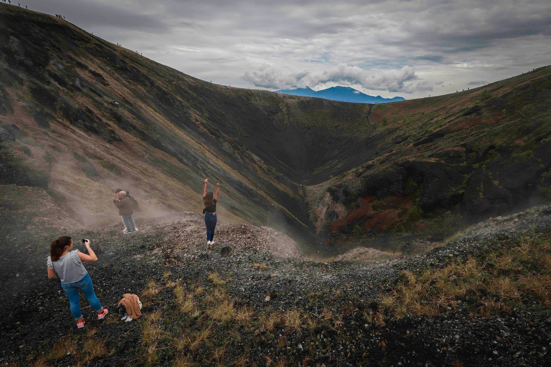
Parícutin is a scoria cone, also widely called a cinder cone. Gas-rich magma rose toward the surface and fragmented as pressure fell. Blobs and pieces of molten rock were thrown into the air, cooled and landed near the vent. Layer by layer, those fragments built a steep cone.
The process explains how the volcano could gain height so quickly. The entire 50-meter mass did not push upward as one solid object. Material was continually ejected and deposited around the source. Lava also escaped from vents near the cone’s base, spreading outward while explosive activity continued above.
A detailed USGS study of the volcano’s birth and development compiled measurements and eyewitness reports from its first days. On the morning of February 21, observers estimated a height of about 10 meters. By noon, estimates ranged from 30 to 50 meters.
The spread is not surprising. Surveying a new cone amid ash, darkness, heat and continuing explosions was difficult. The summit was also changing as observers watched. Fifty meters is defensible as the upper contemporary estimate within roughly the first day, but it should not be read as an exact measurement taken at the 24-hour mark.
Most of the final height came early
UNAM’s 75th-anniversary account of Parícutin gives a useful sequence: about 30 meters in the first 24 hours, 60 meters after three days, 148 meters after one month and 336 meters after a year. The final cone stood 424 meters above the former valley floor.
That last number is relative height, not elevation above sea level. The cornfield was already on the elevated Purépecha Plateau. Parícutin’s summit now sits much higher above sea level than 424 meters, but the quoted figure measures what the eruption added to the local landscape.
The eruption also did not maintain its opening growth rate for nine years. Most of the cone formed early, when ash and scoria were being produced rapidly. Later phases added lava flows and smaller changes to the cone. Activity finally ended in 1952, leaving a volcano whose complete eruptive life fitted within less than a decade.
For nearby communities, observation meant displacement
Parícutin is often celebrated because geologists could observe a volcano from birth. That scientific framing can make the event sound almost fortunate. For the Purépecha communities nearby, it was a prolonged disaster. Ash smothered crops, damaged buildings and made daily life increasingly difficult. Lava eventually forced the abandonment of settlements and farmland.
The village of Parícutin was buried. Lava reached San Juan Parangaricutiro and covered most of the old town, although parts of its church survived above the flow. The tower, facade and altar area now project from dark rock, creating the image most commonly used to represent what the eruption destroyed.
Accounts often state that the eruption caused no direct deaths. That is worth preserving, but it is not a complete measure of harm. Families lost homes, fields and community institutions. Residents had to establish new settlements, and Mexican sources also describe indirect health consequences associated with the eruption and displacement.
The ruined church is memorable because it gives the lava a human scale. Stone walls stand where streets and houses once continued. Yet the building should not become a substitute for the people who had to rebuild their lives elsewhere.
A volcano observed through an entire eruptive life
The International Union of Geological Sciences describes Parícutin as the first volcano followed in detail by modern scientists from the opening of its vent. Geologists arrived quickly, then mapped flows, measured the cone, photographed changes and collected material throughout the 1943 to 1952 eruption.
The eruption did not make Parícutin the youngest volcano on Earth forever, nor was it the first new cone humans had ever witnessed. Its importance lies in the continuity and quality of the observations. Scientists could connect daily changes in activity with deposits and landforms that remained afterward.
Parícutin was monogenetic, meaning the cone and lava field formed during one eruptive episode. The region itself is not volcanically finished. It lies within the Michoacán-Guanajuato volcanic field, which contains many individual vents formed at different times. A future eruption in the field would be expected to open a new vent rather than necessarily restart Parícutin.
That makes it very different from the enormous submarine explosion at Hunga Tonga, which ScienceBlog has previously examined. Both events are called volcanic eruptions, but scale, setting, water interaction and the shape of the resulting landforms differ greatly. Parícutin’s value is partly that its comparatively accessible cone could be watched growing stage by stage.
The church remains, but the landscape is not frozen
Parícutin’s cone and lava field are now part of the landscape. The IUGS assessment places the lava field at about 25 square kilometers. Vegetation has returned unevenly, loose slopes continue to erode, and visitors cross terrain that was productive farmland within living memory.
I find the exactness of the beginning striking: a named person, a known field and a date recorded in documents. Volcanoes are usually introduced through deep time, with their earliest stages reconstructed from rocks. Parícutin entered written history while the opening was still widening.
Its deeper lesson is slower than the first day’s growth. A cone that took shape within hours continued altering land and lives for nine years. When the eruption stopped, the new mountain remained, along with a church emerging from lava and communities remade beyond it.