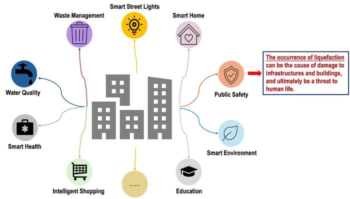
Summary: Japanese researchers have developed a revolutionary AI system that can predict soil stability and liquefaction risks in urban areas. Using artificial neural networks and ensemble learning, the system creates detailed 3D maps of soil layers, helping city planners identify vulnerable areas and make better-informed decisions about infrastructure development.
Journal: Smart Cities, October 8, 2024, DOI: 10.3390/smartcities7050113
Reading time: 4 minutes
The Growing Threat of Liquefaction
When earthquakes strike, the ground beneath our feet can quite literally turn to liquid. This phenomenon, known as liquefaction, has devastated communities worldwide. In Japan alone, the 2024 Noto earthquake caused liquefaction damage to 6,700 houses, while the 2011 Tōhoku earthquake damaged 1,000 homes through soil failure.
The consequences can be catastrophic for urban infrastructure. During the Christchurch earthquake, liquefaction destroyed 80% of the city’s water and sewage systems, highlighting the urgent need for better prediction and prevention methods.
A Data-Driven Solution
Professor Shinya Inazumi and Yuxin Cong from Shibaura Institute of Technology have developed an innovative approach to this challenge using artificial intelligence. Their research, published in Smart Cities, demonstrates how machine learning can revolutionize urban planning in earthquake-prone regions.
“This study establishes a high-precision prediction method for unknown points and areas, demonstrating the significant potential of machine learning in geotechnical engineering,” says Prof. Inazumi.
The team’s methodology is remarkably comprehensive. They collected bearing depth data from 433 points in Tokyo’s Setagaya-ku district, using standard penetration tests and mini-ram sounding tests. This data trained an artificial neural network to predict soil stability, with a technique called bagging improving prediction accuracy by 20%.
From Data to Urban Safety
The practical applications of this research are immediate and far-reaching. The team created detailed contour maps showing soil bearing layer depths within a 1 km radius of selected locations, providing civil engineers with crucial information for construction planning.
“This study provides a foundation for safer, more efficient, and cost-effective urban development. By integrating advanced AI models into geotechnical analysis, smart cities can better mitigate liquefaction risks and strengthen overall urban resilience,” explains Prof. Inazumi.
The system’s potential for preventing disaster damage is significant. Unlike traditional manual soil testing, which can only assess specific points, this AI-powered approach offers comprehensive coverage of entire urban areas, helping identify vulnerable zones before disaster strikes.
Looking to the Future
The research team isn’t stopping here. They plan to enhance their model’s accuracy by incorporating additional ground conditions and developing specialized versions for coastal and non-coastal areas, particularly considering groundwater’s role in liquefaction risk.
Further Reading:
Enjoy this story? Get our newsletter!
If our reporting has informed or inspired you, please consider making a donation. Every contribution, no matter the size, empowers us to continue delivering accurate, engaging, and trustworthy science and medical news. Independent journalism requires time, effort, and resources—your support ensures we can keep uncovering the stories that matter most to you.
Join us in making knowledge accessible and impactful. Thank you for standing with us!

