That underground lake on Mars? Probably just rock and dust.
A new analysis from NASA’s Mars Reconnaissance Orbiter, published in Geophysical Research Letters, suggests the bright radar signal beneath Mars’ south pole—the one that looked so much like a subglacial lake—is more likely coming from buried rock than liquid water. The study also demonstrates how rolling a 19-year-old spacecraft on its side can reveal what’s hiding under Martian ice.
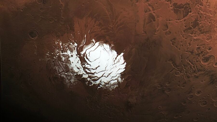
The story started in 2018, when the MARSIS radar instrument on Europe’s Mars Express orbiter reported a strikingly bright reflection about 1.5 kilometers beneath the south polar ice cap. The “High Reflectivity Zone” spanned roughly 20 kilometers. On Earth, radar signatures like that beneath ice sheets usually mean subglacial lakes, so the idea of present-day liquid water on Mars took off fast.
Keeping water liquid at that depth, under current Martian conditions, would require something extreme—hypersaline brines, maybe, or recent volcanic heating. Either way, it would be a big deal: a stable underground water body could be a rare modern habitat for microbial life and a window into how Mars’ climate evolved.
But there was always a problem. NASA’s SHARAD radar, which operates at higher frequencies than MARSIS, couldn’t see the base of the ice at all.
Rolling the spacecraft
SHARAD’s antenna is mounted on the side of the spacecraft that usually faces away from Mars. The spacecraft body blocks much of the signal, weakening what actually reaches the ground. Engineers routinely roll Mars Reconnaissance Orbiter up to 30 degrees to improve the view, but even that wasn’t enough to see through the south polar ice.
So SHARAD scientists Gareth Morgan and Nathaniel Putzig, working with engineers at NASA’s Jet Propulsion Laboratory and Lockheed Martin, developed a “very large roll” mode—a full 120-degree tip that points more of the antenna toward the planet. It’s not trivial to pull off on a spacecraft launched in 2006. You have to manage power, thermal balance, and keep other instruments from interfering. But on May 26, SHARAD performed the roll over the south pole target.
For the first time, the instrument detected a basal reflection from beneath the High Reflectivity Zone.
The surprise was how faint it was. MARSIS had seen a subsurface echo brighter than the surface reflection—up to several decibels stronger. SHARAD registered a signal only about one-thousandth as strong as its own surface echo. The subsurface-to-surface power ratio was around minus 29 decibels, nearly identical to another deep reflector outside the supposed lake area that nobody ever thought was water.
“The lake hypothesis generated lots of creative work, which is exactly what exciting scientific discoveries are supposed to do,” said Gareth Morgan of the Planetary Science Institute, who led the study. “And while this new data will not settle the debate, it makes it very hard to support the idea of a liquid water lake.”
The permittivity problem
Morgan’s team ran the numbers. If there’s really liquid water down there, it should have a very high permittivity—a measure of how strongly material interacts with radar waves. Earlier work with MARSIS suggested values over 20, maybe as high as 40, far above typical rock or ice.
SHARAD’s measurements don’t support that. Across a wide range of plausible ice properties and temperatures, the data point to permittivity values around 4 to 4.5. That’s consistent with dry rock or dust, and essentially identical to the comparison reflector that was never considered a lake candidate.
To keep the lake interpretation alive, you’d need the ice column directly above it to absorb SHARAD’s signal much more than the surrounding ice does, without leaving any trace on shallower layers. The authors find that scenario unlikely.
The study, led by scientists at the Planetary Science Institute, also challenges explanations based on elevated electrical conductivity at the ice base. Those models predicted frequency-dependent reflectivity that SHARAD should have been able to detect. It didn’t.
The very large roll technique, meanwhile, opens up new possibilities. If a 120-degree tilt can reveal the base of Mars’ deepest ice, it could work elsewhere on the planet where radar has struggled to penetrate. That matters for understanding how much water is locked up in Martian ice and where future missions might find accessible resources.
For now, the bright signal under the south pole looks less like a hidden ocean and more like geology doing what geology does—reflecting radar in ways that briefly fooled us into thinking Mars was stranger than it is.
Journal: Geophysical Research Letters
Discover more from European Space Agency Tracker
Subscribe to get the latest posts sent to your email.