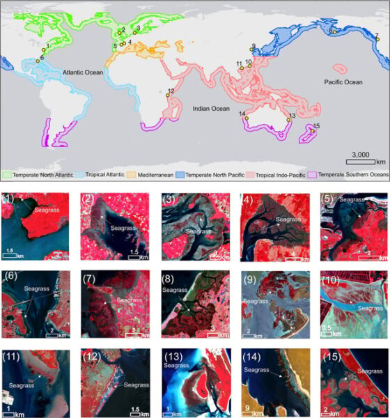
A groundbreaking algorithm that automatically maps and tracks vital seagrass meadows from space could transform coastal ecosystem conservation efforts worldwide. Scientists from Xiamen University and Tulane University have developed a new approach that overcomes long-standing challenges in monitoring these critical but threatened underwater habitats. The new system, called Automatic Mapping through integrating Optical and SAR … Read more
The post Satellite Tool Maps Vanishing Seagrass appeared first on SciChi.
ScienceBlog.com has no paywalls, no sponsored content, and no agenda beyond getting the science right. Every story here is written to inform, not to impress an advertiser or push a point of view.
Good science journalism takes time — reading the papers, checking the claims, finding researchers who can put findings in context. We do that work because we think it matters.
If you find this site useful, consider supporting it with a donation. Even a few dollars a month helps keep the coverage independent and free for everyone.