Skip to content
ScienceBlog.com
  • Featured Blogs
    • EU Horizon Blog
    • ESA Tracker
    • Experimental Frontiers
    • Josh Mitteldorf’s Aging Matters
    • Dr. Lu Zhang’s Gondwanaland
    • NeuroEdge
    • NIAAA
    • SciChi
    • The Poetry of Science
    • Wild Science
  • Topics
    • Brain & Behavior
    • Earth, Energy & Environment
    • Health
    • Life & Non-humans
    • Physics & Mathematics
    • Social Sciences
    • Space
    • Technology
  • Our Substack
  • Follow Us!
    • Bluesky
    • Threads
    • FaceBook
    • Google News
    • Twitter/X
  • Contribute/Contact

satellites

satellite

Earth’s Carbon Footprint Now Threatening Satellite Operations

A new compact and lightweight single-photon airborne lidar system could make single-photon lidar practical for air and space applications such as 3D terrain mapping.

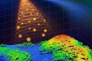
Lidar System Could Transform Aerial 3D Imaging and Save Lives

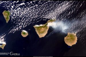
To tackle wildfires, researchers in Europe team up with frontline forces

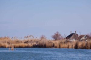
Watching over water, Earth’s most precious resource

In booming satellite market, micro-rockets are the next big thing

Substack subscription form sign up

Comments

  • Norwood johnson on Electrons in New Crystals Behave as If They Live in Four Dimensions
  • ScienceBlog.com on Hidden Geometry Could Finally Fix Quantum Computers
  • Theo Prinse on America Is Going Back to the Moon. This Time, It Plans to Stay
  • george w on Hidden Geometry Could Finally Fix Quantum Computers
  • Tom Hughes on Years of Exercise, Blood Pressure Drugs Failed to Slow Cognitive Decline in Seniors at Dementia Risk
© 2026 ScienceBlog.com | Follow our RSS / XML feed