It started in the dark skies over east Texas and didn’t stop until it reached the outskirts of Kansas City.
A single lightning flash, now officially recognized as the longest ever recorded, streaked across 515 miles (829 kilometers) of atmosphere in one continuous electric event. This astonishing “megaflash” from October 2017 went unnoticed until a recent reanalysis of satellite data, and it’s rewriting what scientists know about lightning’s reach.
What Is a Megaflash, and How Rare Are They?
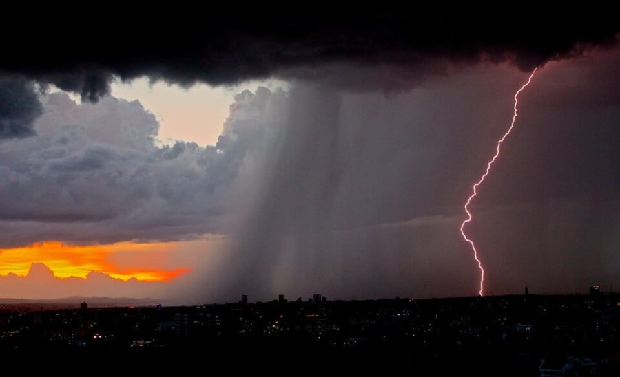
Most lightning bolts span just a few miles. But when a flash crosses 100 kilometers (about 62 miles), scientists classify it as a “megaflash.” These extraordinary events are the rare giants of the lightning world, making up less than 1 percent of all thunderstorms observed from space.
The newly certified 2017 megaflash was recorded by NOAA’s GOES-16 satellite, which has been watching Earth from geostationary orbit since 2017. Thanks to its lightning mapper—a sensitive optical instrument that captures flash timing and length to the millisecond—researchers were able to trace the lightning’s full 515-mile trajectory across the Great Plains.
The Technology That Made It Possible
For decades, lightning detection relied on radio signals picked up by ground-based antennas. But these networks are limited in range and precision. With satellite-based instruments now capable of capturing lightning from space, researchers can detect extreme events across entire continents.
“Our weather satellites carry very exacting lightning detection equipment that we can use to document to the millisecond when a lightning flash starts and how far it travels,” said Randy Cerveny, an Arizona State University climatologist and rapporteur of weather and climate extremes for the World Meteorological Organization (WMO).
The Record-Breaking Flash
This megaflash occurred during a sprawling thunderstorm system known as a quasi-linear convective system, or QLCS, which formed along a sharp cold front sweeping across Texas, Oklahoma, and into Missouri. It wasn’t the height of the storm that caught scientists’ attention, but what came later.
- Initiated at 08:56:45 UTC on October 22, 2017
- Stretched 829 kilometers (515 miles) from eastern Texas to near Kansas City, Missouri
- Lasted 7.391 seconds
- Produced at least 116 cloud-to-ground strokes
- Covered a storm area comparable to the state of New Jersey
The data came from a reprocessed set of GOES-16 lightning observations, analyzed using improved techniques that let scientists peer into difficult-to-detect areas of cloud cover. According to the research team, this megaflash is “prototypical” of the kind of extreme event that can arise from long-lived, well-organized storm systems.
Why It Matters
“These flashes challenge the idea that lightning is a local threat,” said Michael Peterson of the Georgia Tech Research Institute and first author of the WMO report. “We now know that the storm producing a strike doesn’t have to be right on top of you.”
Cerveny added, “That’s why you should wait at least a half an hour after a thunderstorm passes before you go out and resume normal activities. The storm that produces a lightning strike doesn’t have to be over the top of you.”
According to the WMO report, such megaflashes can produce dangerously high-current strokes hundreds of kilometers from the main storm. This includes so-called “bolts from the gray,” where cloud-to-ground strikes occur long after local thunder has faded.
The Bigger Picture
The discovery adds to a growing body of evidence that lightning can behave in ways most people—and even many meteorologists—don’t expect. As satellite lightning detection improves, researchers believe we’re only beginning to uncover nature’s longest electric reach.
“It is likely that even greater extremes still exist,” Cerveny noted. “And that we will be able to observe them as additional high-quality lightning measurements accumulate over time.”
About the Study
The new lightning record is detailed in the Bulletin of the American Meteorological Society, based on work by an international team including researchers from Arizona State University, Georgia Tech, NASA, and several global weather organizations.
Journal: Bulletin of the American Meteorological Society
ScienceBlog.com has no paywalls, no sponsored content, and no agenda beyond getting the science right. Every story here is written to inform, not to impress an advertiser or push a point of view.
Good science journalism takes time — reading the papers, checking the claims, finding researchers who can put findings in context. We do that work because we think it matters.
If you find this site useful, consider supporting it with a donation. Even a few dollars a month helps keep the coverage independent and free for everyone.