Pull every American float, every American mooring, every American research cruise out of the world’s ocean monitoring network and what you have left is worse than if you took a coin and flipped away four-fifths of all the data ever gathered. That, in essence, is the finding of a new paper in Nature Climate Change that has quietly set climate scientists on edge. The system that watches the ocean for us, the one humming away beneath hurricane forecasts and El Niño warnings and fisheries quotas, turns out to be more brittle than almost anyone realised. And the cracks are already showing.
For roughly two decades, the Global Ocean Observing System (GOOS) has stitched together a near-continuous picture of ocean temperature down to 2,000 metres, basin by basin, season by season. It is, in a way, the closest thing the planet has to a thermostat readout.
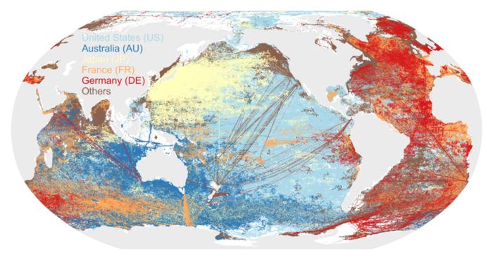
The system is not a treaty. It is not even, really, a single thing. GOOS is a patchwork of robotic Argo floats, ship-based hydrographic cruises, moored buoys in the tropics, animal-borne sensors strapped to elephant seals, and a few thousand expendable probes dropped over the side of cargo ships. Each nation pays for its own platforms, and the data flow into a shared pool that, until now, no one had stress-tested in any rigorous way.
So a team led by Yujing Zhu and Lijing Cheng at the Institute of Atmospheric Physics in Beijing, with collaborators in the U.S., France, and New Zealand, decided to break it on purpose. On paper, at least.
They pulled 20 percent of the observations out at random and watched what happened to estimates of how much heat the ocean is absorbing each year. The error jumped by a third. At 40 percent removal, the error was up 57 percent. At 80 percent, the global warming signal essentially vanished into the noise, the kind of statistical fog where a year of unusually fast warming looks indistinguishable from a year of nothing much happening at all.
“What surprised us most is that geographic reach matters more than sheer data volume,” says John Abraham, an engineer at the University of St. Thomas in Minnesota and one of the paper’s co-authors. “Losing U.S. ocean observations alone would damage global monitoring more than randomly losing 80% of all the world’s ocean data.”
Why a Single Nation Carries So Much Weight
The reason is geography, not patriotism. U.S.-funded platforms account for about 53 percent of all profile observations, but more importantly they span every ocean basin: the deep Southern Ocean where almost no one else operates, the gaps in the central Pacific, the long-running hydrographic transects that crisscross the globe like the seams on a baseball. Pull those out and the map develops holes that no other country’s data can fill. The team measured the consequence: a 163 percent jump in the error of the annual ocean heating estimate, and roughly a 20 percent bias in the rate at which warming itself is accelerating, which is the number infrastructure planners and insurers actually care about.
That last figure is the one that should give pause. Ocean warming acceleration is the input for everything from sea-wall design to actuarial tables.
None of this is hypothetical. The TAO/TRITON mooring array in the tropical Pacific, the same network that gives the world its earliest read on El Niño, already collapsed once, between 2012 and 2014, when maintenance budgets ran dry. Argo float deployments in Europe have slid for years on rising platform costs. And proposals in Washington to cut funding to the National Oceanic and Atmospheric Administration and the National Science Foundation, the two agencies that quietly underwrite most of America’s contribution, would, if enacted, accelerate exactly the scenario Zhu and Cheng modelled.
“Ocean heat increases are a major contributor to sea level rise and changes in ocean currents, with profound influences on ecosystems, including fish and marine life, as well as oxygenation of waters and uptake of carbon dioxide,” says Kevin Trenberth, a coauthor at the University of Auckland. They relate directly, he adds, to Earth’s energy imbalance, the foundational quantity from which almost every other climate projection is derived.
Sabrina Speich of the École Normale Supérieure in Paris, another coauthor, puts the political problem plainly. “No single nation can monitor the global ocean alone. And no nation can afford not to.” The ocean, she notes, does not respect borders, but the consequences of losing track of it will be felt everywhere: in food prices, in storm warnings, in the decisions governments make about their citizens’ lives.
The View from the Equator
The El Niño event now developing across the equatorial Pacific in 2026 will lean on this system in ways most people will never see. Whether harvest planners in Kenya, reservoir managers in California, and rice farmers in Indonesia get useful forecasts depends, more than anyone outside oceanography quite appreciates, on the health of a few thousand drifting robots and the political will of half a dozen treasury ministers.
If that will falters, the consequences will not show up as missing graphs in scientific journals. They will show up as missed storm warnings, mispriced harvests, and surprises that nobody saw coming.
https://doi.org/10.1038/s41558-026-02661-6
Frequently Asked Questions
Why does losing one country’s ocean data matter more than losing most of the data?
Because not all observations sit in the same places. U.S. platforms are spread across every ocean basin, including remote regions where no other nation has a sustained presence. Random data loss thins out everywhere; losing a single major contributor punches geographic holes that the rest of the network cannot plug, no matter how much data still exists elsewhere.
How does ocean heat content actually affect weather forecasts?
Warm subsurface water is the fuel that drives hurricane intensification, monsoon timing, and El Niño cycles. Forecasters use real-time temperature profiles to predict whether a tropical storm will rapidly strengthen before landfall, and whether seasonal rains will arrive on time. Without those profiles, predictions degrade from useful to guesswork, especially in the days before a storm hits.
Is the ocean observing system actually at risk, or is this a hypothetical worry?
It is already eroding. European Argo deployments have declined for several years, the COVID-19 pandemic caused observation losses that have not been fully recovered, and the tropical Pacific mooring network already suffered a serious data gap in the early 2010s. Proposed U.S. budget cuts to NOAA and the National Science Foundation would compound those weaknesses.
What would it take to make the system resilient?
The paper’s authors argue for a shift in how nations think about ocean observing: not as discretionary science spending but as critical infrastructure on par with weather satellites or GPS. That would mean treaty-like coordination, contributions scaled to economic capacity, and broader participation from emerging economies whose food and water security depend on the data but who currently contribute little to collecting it.
ScienceBlog.com has no paywalls, no sponsored content, and no agenda beyond getting the science right. Every story here is written to inform, not to impress an advertiser or push a point of view.
Good science journalism takes time — reading the papers, checking the claims, finding researchers who can put findings in context. We do that work because we think it matters.
If you find this site useful, consider supporting it with a donation. Even a few dollars a month helps keep the coverage independent and free for everyone.