Skip to content
ScienceBlog.com
  • Featured Blogs
    • EU Horizon Blog
    • ESA Tracker
    • Experimental Frontiers
    • Josh Mitteldorf’s Aging Matters
    • Dr. Lu Zhang’s Gondwanaland
    • NeuroEdge
    • NIAAA
    • SciChi
    • The Poetry of Science
    • Wild Science
  • Topics
    • Brain & Behavior
    • Earth, Energy & Environment
    • Health
    • Life & Non-humans
    • Physics & Mathematics
    • Social Sciences
    • Space
    • Technology
  • Our Substack
  • Follow Us!
    • Bluesky
    • Threads
    • FaceBook
    • Google News
    • Twitter/X
  • Contribute/Contact

Mars

NASA’s Curiosity Mars rover used two different cameras to create this selfie in front of Mont Mercou, a rock outcrop that stands 20 feet tall. New analysis by Penn State researchers reveals that much of the craters on Mars today could have once been habitable rivers. Credit: NASA/JPL-Caltech/MSSS. All Rights Reserved.

Curiosity rover finds new evidence of ancient Mars rivers, a key signal for life

Martian dustdevil

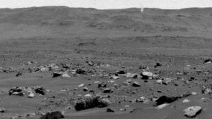
NASA’s Perseverance Captures Dust-Filled Martian Whirlwind

This raw image from the Curiosity Rover shows the hexagon-shaped mudcracks filled with salt.

New insights into the potential for early steps of biological evolution on Mars

Image of the Terra Sirenum and its gullies captured by the High Resolution Imaging Science Experiment (HiRISE) camera on NASA's Mars Reconnaissance Orbiter.

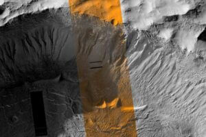
Gullies on Mars could have been formed by recent periods of liquid meltwater

Bands of rocks may have been formed by a very fast, deep river – the first such evidence found for on Mars

Wild river on Mars emerges from images, rock evidence

Mars and water

Rover finds evidence of water at low latitudes on modern Mars

The new global mosaic, shown in a detail example at left, is stitched together with images taken by MRO's Context Camera, which captures the Martian surface in long strips.

Scientists Unveil a 5.7 Terapixel Global Image of Mars

Figure 1: A Relict Glacier near Mars’ Equator. (NASA MRO HiRISE and CRISM false color composite. Lee et al. 2023).

Glacier near Mars equator implies water possibly present today

Mars

Better tools needed to determine ancient life on Mars

A selfie taken by the Zhurong rover alongside its landing platform, captured with a wireless camera. Source: CNSA.

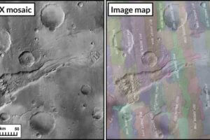
Complex subsurface of Mars imaged by Chinese rover Zhurong

Mars rover Perseverance helped scientists study layered rocks like these in Jezero Crater on the Martian surface. Scientists initially thought they were sedimentary rocks, but further examination showed them to be igneous rocks – solidified lava. These rocks show evidence of interaction with water, but on a limited basis. They date back nearly 4 billion years, giving scientists a window into what conditions on the early planets were like. (Image/NASA/JPL-Caltech/ASU)

Mars was covered by 300 meter deep oceans

Newer posts
← Previous Page1 Page2
Substack subscription form sign up

Comments

  • Sue Ann Hayes on Hidden Nuclear Protein Fuels Pancreatic Cancer’s Deadly Aggression
  • Curtis Webber on The GPS-Killer? This Quantum Device ‘Feels’ Motion Like a Brain—Down to the Atomic Level
  • Ran on How the Age You First Had Sex Could Shape How You Age Decades Later
  • Sparty on How the Age You First Had Sex Could Shape How You Age Decades Later
  • Josh Mitteldorf on A Single TV Segment Sent Leucovorin Prescriptions for Autistic Children Soaring 2,000 Percent
© 2026 ScienceBlog.com | Follow our RSS / XML feed